

Wakefield 🇺🇸
-
Nautical Twilight begins:04:18 amSunrise:05:29 am
-
Sunset:07:52 pmNautical Twilight ends:09:03 pm
-
Moonrise:05:29 am
-
Moonset:09:03 pm
-
Moon over:01:16 pm
-
Moon under:12:57 am
-
Visibility:0%
-
 New Moon
-
Distance to earth:373,283 kmProximity:76.1 %
Moon Phases for Wakefield
-
excellent Day
-
minor Time:
 04:29 am -
06:29 am
04:29 am -
06:29 am
-
major Time:12:16 pm - 02:16 pm
-
minor Time:08:03 pm - 10:03 pm
-
major Time:11:57 pm - 01:57 am
Tide Clock
Tide Graph
Times
| Tide | Time | Height |
|---|---|---|
| low | 06:00 am | -1.51 ft |
| high | 12:18 pm | 10.17 ft |
| low | 06:12 pm | -0.36 ft |
| Date | Major Bite Times | Minor Bite Times | Sun | Moon | Moonphase | Tide Times |
|---|---|---|---|---|---|---|
|
Wed, 08 May
|
12:16 pm -
02:16 pm
11:57 pm -
01:57 am
|
04:29 am -
06:29 am
08:03 pm -
10:03 pm
|
R: 05:29 am S: 07:52 pm |
R: 05:29 am S: 09:03 pm |
New Moon |
low: 06:00 am
, -1.51 ft
high: 12:18 pm
, 10.17 ft
, Coeff: 123
low: 06:12 pm
, -0.36 ft
|
|
Thu, 09 May
|
12:48 am -
02:48 am
01:12 pm -
03:12 pm
|
05:06 am -
07:06 am
09:18 pm -
11:18 pm
|
R: 05:28 am S: 07:53 pm |
R: 06:06 am S: 10:18 pm |
New Moon |
high: 12:29 am
, 11.48 ft
, Coeff: 149
low: 06:50 am
, -1.51 ft
high: 01:08 pm
, 9.94 ft
, Coeff: 118
low: 07:00 pm
, -0.1 ft
|
|
Fri, 10 May
|
01:41 am -
03:41 am
02:09 pm -
04:09 pm
|
05:53 am -
07:53 am
10:25 pm -
12:25 am
|
R: 05:27 am S: 07:55 pm |
R: 06:53 am S: 11:25 pm |
Waxing Crescent |
high: 01:17 am
, 11.29 ft
, Coeff: 145
low: 07:40 am
, -1.25 ft
high: 01:59 pm
, 9.61 ft
, Coeff: 112
low: 07:49 pm
, 0.3 ft
|
|
Sat, 11 May
|
02:32 am -
04:32 am
03:04 pm -
05:04 pm
|
06:49 am -
08:49 am
11:20 pm -
01:20 am
|
R: 05:26 am S: 07:56 pm |
R: 07:49 am S: - |
Waxing Crescent |
high: 02:05 am
, 10.93 ft
, Coeff: 138
low: 08:29 am
, -0.82 ft
high: 02:49 pm
, 9.22 ft
, Coeff: 104
low: 08:38 pm
, 0.75 ft
|
|
Sun, 12 May
|
03:36 am -
05:36 am
04:10 pm -
06:10 pm
|
07:52 am -
09:52 am
11:20 pm -
01:20 am
|
R: 05:25 am S: 07:57 pm |
R: 08:52 am S: 12:20 am |
Waxing Crescent |
high: 02:55 am
, 10.4 ft
, Coeff: 127
low: 09:20 am
, -0.26 ft
high: 03:41 pm
, 8.79 ft
, Coeff: 95
low: 09:29 pm
, 1.21 ft
|
|
Mon, 13 May
|
04:31 am -
06:31 am
05:05 pm -
07:05 pm
|
12:03 am -
02:03 am
08:59 am -
10:59 am
|
R: 05:24 am S: 07:58 pm |
R: 09:59 am S: 01:03 am |
First Quarter Moon |
high: 03:48 am
, 9.84 ft
, Coeff: 116
low: 10:12 am
, 0.33 ft
high: 04:36 pm
, 8.43 ft
, Coeff: 88
low: 10:23 pm
, 1.64 ft
|
|
Tue, 14 May
|
05:22 am -
07:22 am
05:55 pm -
07:55 pm
|
12:37 am -
02:37 am
10:07 am -
12:07 pm
|
R: 05:23 am S: 07:59 pm |
R: 11:07 am S: 01:37 am |
First Quarter Moon |
high: 04:43 am
, 9.32 ft
, Coeff: 106
low: 11:06 am
, 0.82 ft
high: 05:32 pm
, 8.17 ft
, Coeff: 83
low: 11:20 pm
, 1.97 ft
|


uploaded by: Tom Dominick

uploaded by: Cavaliers

uploaded by: FishPhantom1
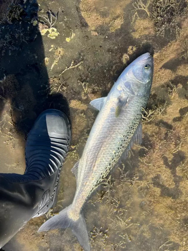
uploaded by: arwood52130

uploaded by: Dezzi23

uploaded by: Sledhead84

uploaded by: Terry Foster

uploaded by: Mick.e

uploaded by: Mick.e

uploaded by: Mick.e
wykfyld, masachwst,ویکفیلد، ماساچوست
Best Fishing Spots in the greater Wakefield area
We found a total of 98 potential fishing spots nearby Wakefield. Below you can find them organized on a map. Points, Headlands, Reefs, Islands, Channels, etc can all be productive fishing spots. As these are user submitted spots, there might be some errors in the exact location. You also need to cross check local fishing regulations. Some of the spots might be in or around marine reserves or other locations that cannot be fished. If you click on a location marker it will bring up some details and a quick link to google search, satellite maps and fishing times. Tip: Click/Tap on a new area to load more fishing spots.
Monk Island - 1km , Crystal Lake Dam - 1km , Lake Quannapowitt Dam - 2km , John A W Pearce Lake Dam - 3km , Lynn Waterways Dam - 3km , Spring Pond - 3km , John Leo Silver Lake Dam - 4km , Griswold Pond Dam - 4km , Lower Pond - 4km , Pillings Pond - 4km , Pillings Pond Dam - 4km , Buckman Pond - 4km , Hawkes Pond Outlet Dam - 5km , Whittemore Pond - 5km , Ell Pond - 5km , Doleful Pond - 5km , Dike Pond - 5km , Burbank Pond - 5km , Humphreys Island - 6km , Long Pond - 6km , Winona Pond Dam - 6km , Great Island - 6km , Walden Pond Outlet Dam - 6km , Nells Pond - 6km , Dark Hollow Pond - 6km , Pomps Pond - 6km , Prankers Pond - 6km , Suntaug Lake Dam - 6km , Suntaug Lake - 6km , Spot Pond - 6km , Stevens Pond - 6km , Aberjona Pond - 7km , Little Elder Pond - 7km , Middle Reservoir Dike - 7km , Fells Reservoir North Dike - 7km , Fells Reservoir Middle Dike - 7km , Elginwood Pond - 7km , North Reservoir Dam - 7km , Devils Dishfull Pond Dam - 7km , Pierces Pond - 7km , Quarter Mile Pond - 7km , Scotts Pond - 7km , Swains Pond - 7km , Towners Pond - 7km , Woodrough Pond (historical) - 7km , Walden Pond East End Dam - 8km , Elginwood Pond Dam - 8km , Mill Pond South Dike - 8km , Ipswich River Dam - 8km , South Reservoir East Dike - 8km , South Reservoir Dam - 8km , Mill Pond Main Dam - 8km , Birch Pond Dam - 8km , Judkins Pond - 8km , Mill Pond - 8km , Horn Pond Dam - 8km , Cedar Pond - 8km , Wrights Pond Dam - 8km , Cutters Pond - 8km , Wedge Pond Dam - 8km , Crystal Pond - 8km , Fellsmere Pond - 9km , Breeds Pond Outlet Dam - 9km , Bellevue Pond - 9km , Mill Pond North Dike - 9km , South Reservoir West Dike - 9km , Lily Mere - 9km , Sawmill Pond (historical) - 9km , Tannery Pond - 9km , Winter Pond - 9km , Bartholowmew Pond - 9km , Craig Pond - 9km , Lynn Reservoir Dam - 9km , Swan Pond - 10km , Mystic Lakes - 10km , Upper Mystic Lake Dam - 10km , Flax Pond - 10km , Fox Hill Bridge - 10km , Middleton Pond - 10km , Martins Pond Dam - 10km , Sluice Pond Dam - 10km , Browns Pond Dam - 10km , Bradford Pond - 10km , Frog Pond - 11km , Fountain Pond Dam - 11km , Middleton Pond Outlet Dam - 11km , Floating Bridge Pond - 11km , Peabody Reservoir (historical) - 11km , Sidneys Pond - 11km , Aunt Betts Pond - 11km , Lower Mystic Lake - 11km , Salem Pond - 11km , Medford Pipe Bridge (historical) - 11km , Sydneys Pond Dam - 11km , General Edwards Bridge - 11km , Field Pond Dam - 11km , Emerson Brook Lake Street Dam - 11km , Frye Pond - 11km
Comments